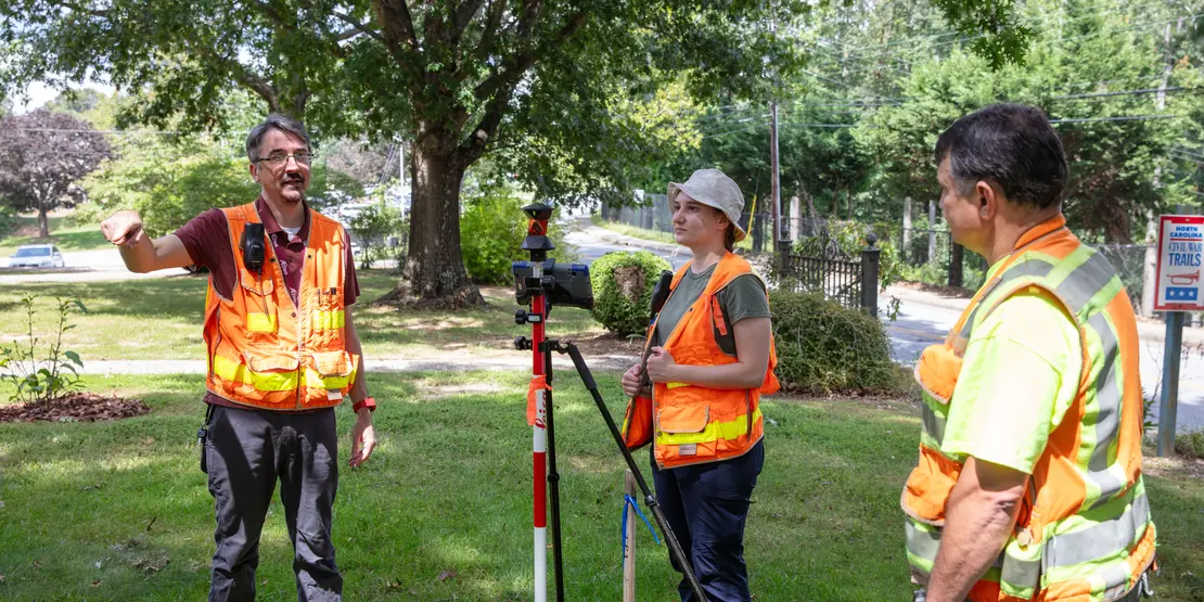
When Hurricane Helene hit Western North Carolina, floodwaters rose high above riverbanks and streams, shifting long-established waterways and land. In the aftermath, an increased demand for land surveyors led to the revival of A-B Tech’s Geomatics Technology program, which had been closed a few years ago due to declining interest.
The Geomatics program is training local students to re-establish property boundaries as they existed before the storm. Whether studying for a certificate or a two-year degree, students acquire on-the-job skills they can immediately put to use in the community.
What exactly do surveyors do? Geomatics instructor Chris Milan described this exciting field as one that combines public service with evidence-gathering and map-making. The terms “geomatics” and “surveying”, both used in the field, are interchangeable. Surveyors, he said, are experts at measuring points on, above, and below the earth’s surface. They may be part of a crew that includes engineers, landscape architects, and urban planners. Surveyors perform many tasks, including protecting property boundaries, creating subdivisions, and performing surveys for construction planning.
“One thing I love about this field is our allegiance to protect the public,” Milan said. “We get called if two neighbors are fighting about a property line. But if I’m surveying for my client, I’m also working for the neighbor. Our job isn’t to determine ownership. It’s to protect the property and welfare of both parties.”
There is currently a great need for surveyors because many local properties were defined by rivers and streams that were shifted by the Helene floodwaters. From highways to residential projects, Milan said surveyors in western North Carolina face a unique challenge.
“If you go to bed the night before and then the river moves 20 feet over, does the boundary line move with it?” Milan asked. “No; a surveyor’s job is to place the boundary back where it was before Helen hit. We look at aerial photography and physical evidence like deeds, and we fit the puzzle pieces back together.”
Within the field of Geomatics, A-B Tech offers both a two-year Associate of Applied Science degree in Geomatics Technology and a short-term certificate program. The Geomatics Technology and Land Surveying certificate offers students five classes and a mix of experience, both with surveying and AutoCAD design software. After completing the certificate, students are qualified to work as surveying technicians or instrument operators in the public and private sectors. Surveying technicians perform fieldwork under the supervision of a Professional Land Surveyor (PLS).
All 50 states and the District of Columbia require surveyors to be licensed before they can provide their services to the public. A-B Tech’s two-year Geomatics Technology degree prepares students for licensure and to become crew leaders or survey CAD technicians. After five years of working under a PLS, they must pass one state exam and two national exams before being eligible to work as a PLS, which does many things, including overseeing employee training, processing data, field work, and research. According to Milan, every firm needs at least one PLS at the helm, and many have 10 to 15.
A-B Tech student David Turner, 54, recently returned to college to get his two-year degree after more than three decades working in the field. He currently runs land survey services in the southeast region for Resource Environmental Solutions (RES). He also serves as a volunteer for the North Carolina Society of Surveyors. The degree will qualify him to receive his licensure in states with more stringent requirements. At RES, Turner works with his wife, an A-B Tech Geomatics Technology alum, who is a PLS.
Turner, who is also currently pursuing a four-year degree in archeology from the University of Florida, said he was attracted to the field out of a love for being outdoors.
“I like that the job changes from week to week,” he said. “One day you’re measuring a boundary on a piece of property; the next week you’re staking out construction points for a new bridge being built.”
A-B Tech student Rachel Zaiken, 25, said she found her way into surveying unexpectedly, while at a career crossroads. At the time, Zaiken, who currently works in manufacturing at Pratt and Whitney, had done one semester in A-B Tech’s nursing program and decided it wasn’t for her. She was taking a gap year when friends told her about a surveyor they had hired to help establish boundaries on their land. They urged her to check it out because it seemed like an interesting and good-paying career. Zaiken shadowed an A-B Tech surveying class, watched students conduct fieldwork on campus, and was instantly hooked.
“I like working outdoors,” she said. “The more I get to know about the field, the more I like it. I can start my own business, be a project coordinator or a drafter, or be on a field crew. Whatever you want, you can do it all.”
Learn more about the Geomatics Technology program at Geomatics Technology (Surveying) or contact instructor Chris Milan at christopermilan@abtech.edu. To apply, students need to take English and Math placement tests, which they can do at any time before spring semester classes start in January. Scholarships are also available through the N.C. Society of Surveyors.